For over three millennia, cities around the world have been crucibles of civilization. Yet, the contemporary city, located largely in the global South, is increasingly emerging as a site that simultaneously evokes excitement and anxiety. While being positioned as centers of growth and prosperity, urban areas also showcase severe deficits in basic service provision, public spaces, ecological compromises as well as socio-cultural neglects.
Why? A lot of scholarly research has gone into this, and numerous planners have pondered over the ground realities of the 21st century Southern city. As a result, there is now a mounting call for alternatives that address and are embedded within these realities. In effect, this would imply moving away from the current dominant planning approach, which is argued to be borrowed, imposed and an 'uncritical import' from 19th to mid-20th century town planning and regulatory practices in Britain and the USA. With its emphasis on orderly development of cities through strict spatial segregation of land uses, this dominant discourse is at odds with the mixed land-use of the Southern city.
India is no exception to this. Planning for human settlements in the country follows spatial planning – mainly land-use planning - in select urban areas and, socio-economic planning mainly for rural settlements. The former is often codified as Master Plans or Development Plans. These are land-use plans prepared under the statutory guidelines of the Town and Country Planning Acts of the states. The frameworks, much like the land-use plans they produced are a colonial legacy, emerging myopic in their approach. Thus, re-imagining and retelling the urban in India will have to necessarily start with an overhaul of these frameworks – the Bird's-Eye view to planning.
What is - not - a Master Plan?
It's not clear why the dominant planning tools are referred to as Master Plans. Dictionary meanings of Master Plans as a noun in British English refer to "a clever plan that is intended to help someone succeed in a very difficult or important task." In American English it refers to a 'general plan or a programme for achieving an objective.'
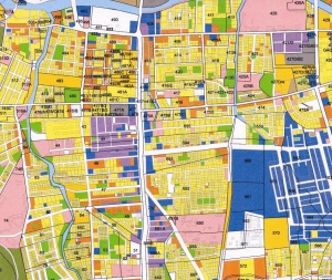
Clearly, the Master Plan is a critical document and tool for guiding or steering planned development in a region. But what constitutes a Master Plan? Most state laws do not define what a Master Plan / Development Plan is, although there is clarity on what it comprises of. In Karnataka, the Master Plan consists of a series of maps and documents indicating the manner in which the development and improvement of a the area within the jurisdiction of a planning authority are to be carried out and regulated. It includes proposals for zoning of land-use in defined categories, e.g. residential, commercial, industrial, agricultural, recreational, educational, etc.
The plans also include Zoning Regulations to facilitate the implementation of the existing and proposed land use zones. Further the plans are required to outline a complete street pattern, indicating major and minor roads, national highways, state highways and traffic circulation pattern for meeting immediate and future requirements with proposals for improvements as well as areas reserved for parks, playgrounds and other recreational uses, public open spaces, public buildings, institutions and areas reserved for such other purposes as may be expedient for new civic developments.
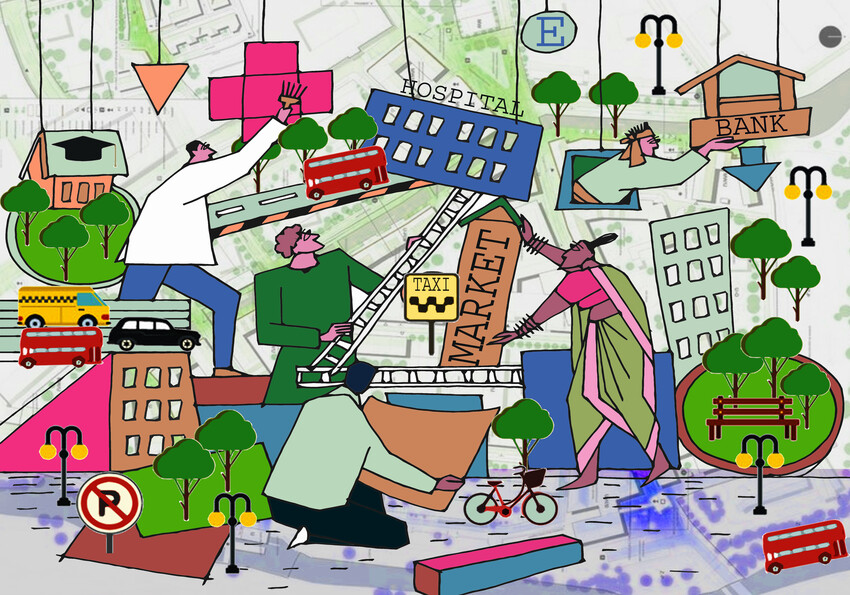
There are several things wrong with framing it this way. Barring a few recent exceptions such as Delhi, zoning in most cities does not allow mixed use of land, despite this being emphasized by several public policies and concepts such as transit-oriented development, new urbanism, liveable communities, and smart growth principles. Mixed land-use co-locates more than one type of land-use. It allows for compatible land-uses across residential, commercial, recreational, educational and even industrial in a given neighbourhood.
This should be an easy concept for Indian cities to absorb, because clearly, most of them are already mixed use jurisdictions. There is also ample evidence from around the world supporting the benefits of mixed land-use, which far outweigh its costs. Nonetheless, this does not find mention in most planning Acts in India.
Second, the laws are yet to factor in innovative and progressive concepts that have become standard around the world - such as mobility, resilience and natural resource planning, and public participation, among others. The state planning Acts for the most part continue to focus on allocating land for roads and transportation infrastructure rather than conceptualising mobility. Similarly, the focus is on land reservations for parks, playgrounds and other recreational places as against integrating commons and prioritizing natural resource planning and management.
Clearly, a critical orientation of resource planning in missing from the Master Plans, severely compromising city resilience, another emerging imperative amidst unprecedented urbanisation. The laws are also full of inputs and outputs, with little attention paid to the outcomes that should be their focus.
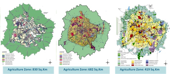
The city as an ever-expanding construction site - the Master Plans of Bengaluru.
Third, the approach to basic services such as water supply, sanitation and sewerage as well as critical social infrastructure such as schools and hospitals are all mainly in terms of allocating land. The planning for these utilities continues to be the domain of other organisations rather than the planning agency. As a result, most Master Plans do not incorporate sectoral plans, visions and targets, and the various other departments are also not mandated to be involved in the evolution, enforcement and implementation of the spatial plan. In other words, planning is the domain of a single agency – the development authorities - with a singular focus – land-use allocation.
Who does the planning?
Barring Maharashtra and more recently Kerala, planning in most states across the country is the domain of specially constituted para-statal development authorities. The jurisdiction of these authorities usually extends beyond the boundary of a city - big and small. In large metros, the planning jurisdictions cover several towns and villages. The jurisdictions, while delineated with foresight to secure land for future urban expansion, have serious implications on the ownership of plans, and for those who own land in these extended areas.
Critically, municipalities and citizens are missing from the evolution of plans. The Acts mandate various stages in plan-making where "public comments and suggestions" are to be elicited. This is not the same as eliciting participation through the plan-making process or consulting various stakeholders including those state departments that are critical to running and managing the city. At most the interface with the latter is purely transactional, perhaps to collect data or other requirements. In effect, the process is siloed within the para-statal with minimal engagement with the larger stakeholder group.
This goes against the grain of the 74th Constitutional Amendment Act, 1992 and its premise of subsidiarity - i.e. bringing governance closer to the people. The Amendment seeks to democratise planning through elected planning and governance institutions to be set up at the sub-municipal scale and the metropolitan scale. Planning is envisaged as an iteration between these integrated functions though a hitherto missing bottom-up and metropolitan scale processes, to be operationalised through the establishment of ward-committees and Metropolitan Planning Committees respectively. These provisions have either been implemented tardily or not implemented at all, thus rendering the planning tool limp.
Who owns the Plan?
In the current scenario, while the plan is prepared by the para-statal, enforcement and implementation is largely relegated to the local bodies. Given that the latter are not party to the preparation of the plans, the ownership of the plan is compromised at the very beginning. They also don't have the budgets to carry out much of the infrastructure development that is typically proposed in a plan. At the same time, the para-statals do not claim the plan either, and the state governments that get the plans prepared through the para-statals do not feel obliged to fund them in their annual Budgets.
As for the citizen, she remains marginal to the entire process at all times. Without a citizen-centric process to prepare the plan, she is left out by design. A few individuals may typically demand more involvement, and occasionally the courts may even grant some of it. Yet this is reactionary, and has remained no more than tokenism.
The net result of all this is that Master Plans are created to meet the letter of the law, but thereafter not paid much attention to. It is no wonder, then, that cities – big and small- are a mess. Urbanisation in India is accompanied by sprawls premised on conversion of agricultural land, shrinkage of surface water bodies, groundwater depletion, water, noise and air pollution, curtailed or even missing housing and basic services, inadequate social and physical infrastructure amongst other ills.
But not all is lost
Disconcerting as this narrative may seem, I would like to end on a positive note. Despite these conceptual and methodological challenges confronting the planning and governance of cities in India, there are already substantial policy directives and actions at various scales that provide hooks to address these challenges. To begin with, the 74th CAA, 1992 serves as a platform for reform. It encourages states to think forward and democratise planning with direct and indirect citizen and larger stakeholder participation.
 |
In addition several policies mandate integration with the spatial planning tools. In the recent past, the National Urban Transport Policy, 2014 envisaged city-specific, citizen-centric mobility plans premised on an integration of land-use and transport planning. The policy also recommends integration at the institutional and organisational functions, along with a dedicated fund. Similarly, the Pradhan Mantri Awas Yojana, 2014 mandates the integration between housing plans and master plans. The revised guidelines for Urban and Regional Development Plans Formulation and Implementation (URDPFI) call for direct and indirect participation of citizens during the evolution of plans. These and other hooks can be leveraged to bring in the much needed overhauling of the archaic formal frameworks that steer planning and governance of the Indian city.
Urban India is clearly entangled in a complicated and messy arrangement for planning and governance. Extricating ourselves from this must begin with the reformation of the Bird's-Eye view.


