The proposed Navi Mumbai airport has been discussed at length in a spate of recent articles that highlighted controversies regarding the destruction of mangroves and the environmental clearance required from the Ministry of Environment and Forests. But what are the other implications of such major investments so close to the shoreline?
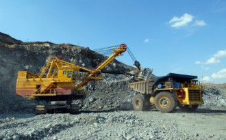
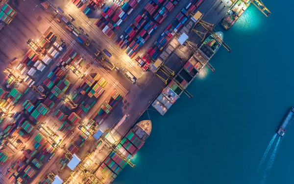
Crores of new investments are being added to already existing major infrastructure along the length of India's roughly 6,000 km coastline. These include new airports, power plants, chemical and other industries, ports, roads, highways and resorts. What will happen to these structures when the sea rises as a result of global warming? Sea level rise (SLR) is expected to lead to more intense storms, higher storm surges, salt-water intrusion, coastal erosion and flooding. These will result in loss of livelihoods, challenges to coastal agriculture, fishing, destruction of coastal ecosystems, shortage of fresh water and migration from some low lying areas.
One would expect that financial institutions with a vested interest in this infrastructure - such as the banks providing loans, bilateral investing agencies, the government and private companies themselves - would be concerned about the crores of rupees put at risk by poor planning for climate change since the infrastructure is supposedly built to last many decades. However, the apparent lack of concern by most investors could indicate a lack of awareness of the seriousness of the challenge, which is more imminent than, say, a terrorist security threat to the coastline.
We are now living in a warmer world with changing weather patterns and monsoons, melting glaciers, reduced agricultural yields and, shortages in the availability of fresh water and food, and sea level rise. Even though the Intergovernmental Panel on Climate Change (IPCC) indicated a maximum rise of 59 cm by 2100 in its 2007 report, one to several metres of sea level rise are now anticipated by glaciologists who study glaciers in Antarctica and Greenland and other climate scientists. Many of them have noticed that the rate of melting of glaciers in West Antarctica and Greenland has accelerated. And the IPCC had in any case made it clear that ice dynamics, or changes in the rate of glacier melts and various feedback effects, had not been taken into consideration in its report. The melting glaciers and expanding waters of warmer oceans will lead to a rise in mean sea levels.
How rapidly the changes will take place is hard to predict. We also don't know the pattern of sea level rise - whether it will be steady, rapid or a combination depending on triggers and tipping points that may accelerate melting or warming. Geological data from the Pliocene period when the temperature was about 3 to 4 degrees warmer than today, which is where the world appears to now be headed, indicate that sea levels then were about 30 metres higher than they are today. We can therefore anticipate several metres of SLR, and need to prepare in advance for such a possibility.
Tamilnadu study
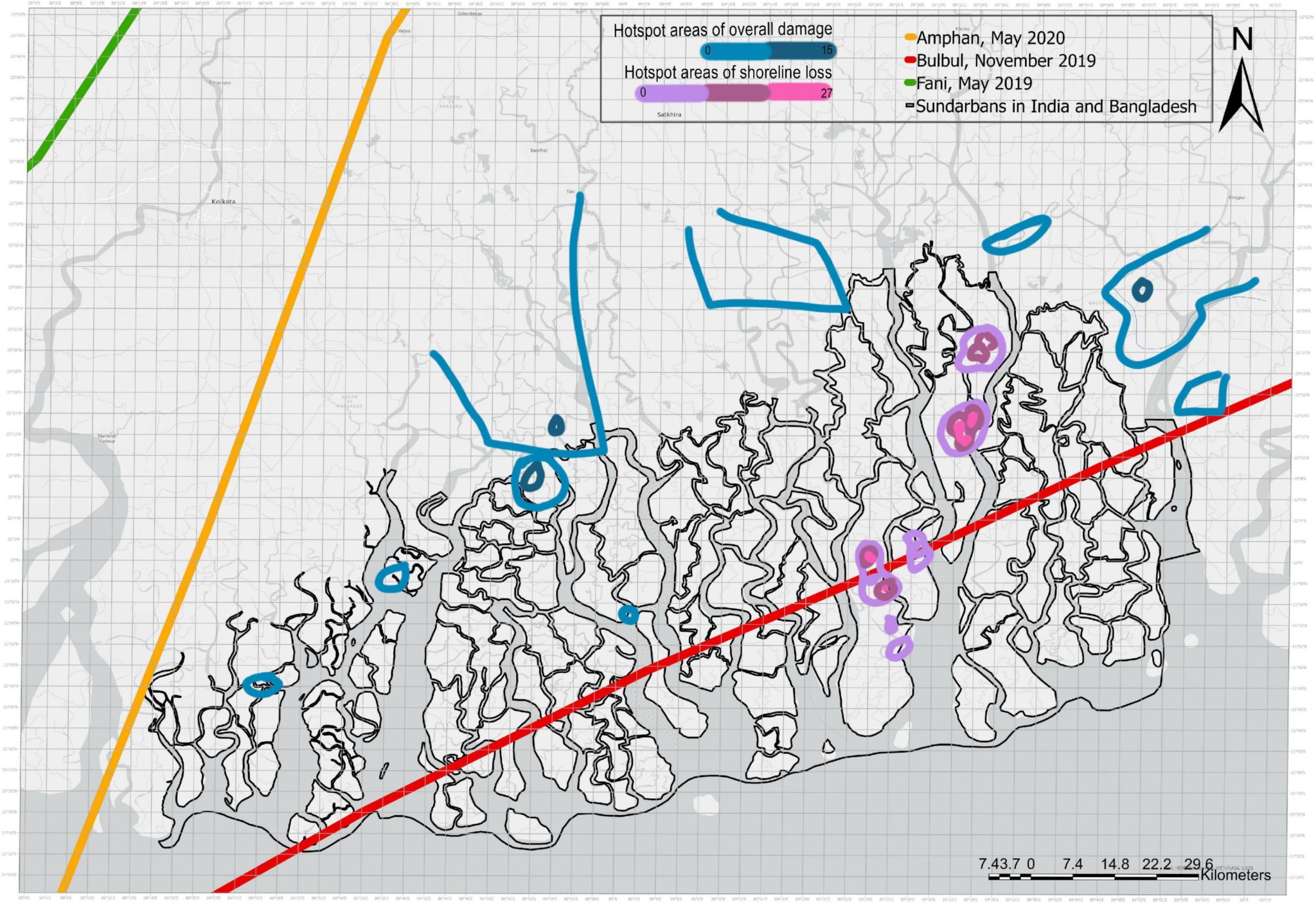
A recent study I led estimates that lakhs of crores of rupees would be at risk along the Tamilnadu coast as a result of a 1-metre rise in mean sea level. The study used Geographic Information Systems and investment data available mostly in the public domain. While the damage to lives and livelihoods as a result of SLR is likely to be extensive, especially if there is little advance preparation, this study focuses on infrastructure, ecosystems and land.
With the exception of structures that absolutely need to be at the coast, new developments should be planned at considerable distance from the coastline.

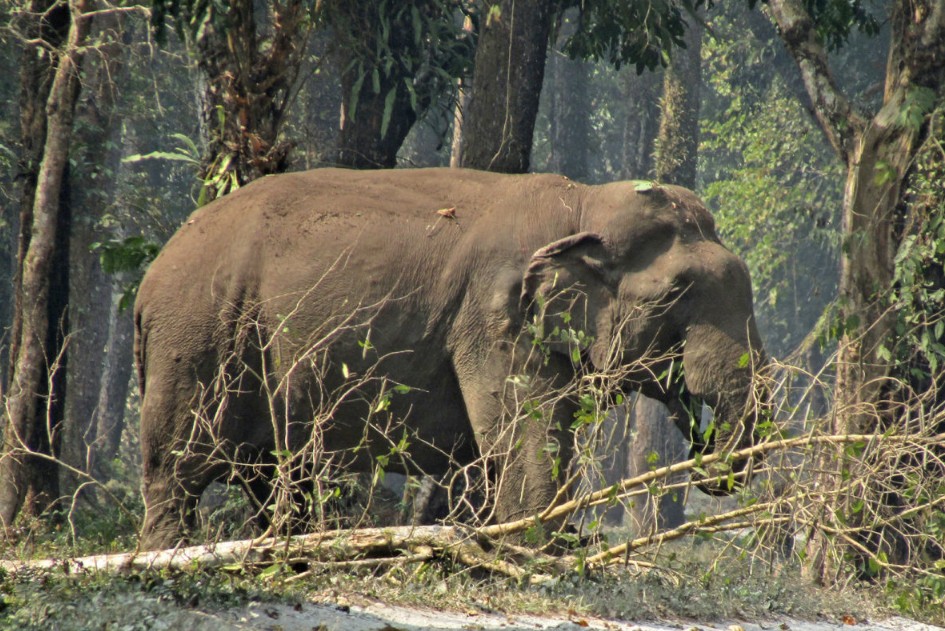
In addition there are fragile ecosystems with wetlands, mangroves, river deltas, and coral reefs along the Tamilnadu coast. Pulicat Lake to the north is mostly in Andhra Pradesh with a small portion in Tamilnadu. But the mangroves of Pichavaram and Muthupet, the swamps of Vedaraniyam, host to migratory birds, and the Gulf of Mannar biosphere reserve, are sensitive ecosystems along the Tamilnadu coast.
Human activity along the coast has already had an adverse impact on people and ecosystems. There is, for instance, salt water intrusion due to excessive pumping of fresh water, unregulated release of chemical effluents from factories, pesticides and fertilisers from agriculture, salinisation of the soil by shrimp farms and ports that modify the naturally occurring littoral drift (the movement of sand by waves and the currents, along the coast). Thus the adverse effects from climate change will be experienced along with these ongoing changes that are taking place as a result of current development activities.
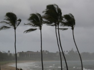
Cyclones strike the Tamilnadu coast with regularity. Storms are accompanied by a surge of the water - quite apart from the waves themselves. Studies by the regional meteorological centre using historical data on the intensity of storms in Tamilnadu identified five coastal districts as being more vulnerable to storm surges than the others. These are Nagapatttinam, Thiruvarur, Thanjavur, Pudukottai and Ramanathapuram. The tsunami that hit the area in 2004 revealed the vulnerability of the coastline.
The tsunami, of course, is a very rare phenomenon that we could not anticipate. On the contrary, we can be quite sure of sea level rise, as the world gets warmer. Being forewarned, we can prepare for it.
Results of the study
The area of land that would be inundated by the rising sea was calculated to be 1091 square kilometres. The area at risk, however, is much larger since we have to take into consideration the intensity of storm surges, erosion and other impacts from SLR. Typically, in such studies the area at risk is taken to be the land below the 10-metre contour line; we used this for the five very vulnerable coastal districts, and the 5-metre line elsewhere, to determine the total extent of land that would be at risk from SLR.
District by district, we looked at the infrastructure investments made along the coast within this at-risk zone, and also the investments that are proposed to be made. The total replacement cost of power plants, major roads such as the East Coast Road and ports that would be at risk from a 1-metre rise in sea levels was found to be between Rs.47,000 and 54,000 crores (in 2010 terms). This high value was in spite of the study not including the value of resorts, shrimp farms and SEZ industries and other commercial enterprises, due to the difficulty in obtaining data on the investments.
The value of mangroves likely to be destroyed was estimated by methods used in other parts of South and East Asia, and was estimated as forgone ecosystem services through 2050. This was found to be at least Rs.3500 crores, and possibly as high as Rs.14,500 crores.
The largest impact would be on land. The market value of land at risk was determined for agricultural, private and residential land. The value of land at risk was found to be between Rs. 3,17,661 crores and Rs. 61,15,471 crores. In comparison, Tamilnadu's annual GDP is around Rs.2,75,000 crores - indicating that a significant value is at risk due to sea level rise alone.
In addition, even though many important structures were above the 10-m contour line and therefore safe from the impact of a 1 metre sea level rise, one cannot estimate the force and power of high sea levels, intense storms and their ability to erode the shoreline. Thus, although structures such as the nuclear power plants, for instance, are above the area at risk, we cannot predict the extent of erosion on the land around them following intense storms and high sea levels. A geomorphlogical analysis of the coast is needed so that we would have better information on coastal vulnerability.
Recommendations
We need a comprehensive vulnerability assessment of the entire Indian peninsula. Although this particular study concentrated on Tamilnadu using it as a case study, other parts of the coast in West Bengal, Orissa, Andhra Pradesh, and Kerala are far more vulnerable to intense storms, flooding and erosion. A more comprehensive analysis should take erosion into consideration along with additional investment details to estimate vulnerability in greater detail.
Thus far, in coastal planning and development, climate change considerations have not been taken into consideration. It is now urgent to do so. Existing structures in areas at high risk may need to be strengthened or modified to withstand the high storms and sea levels. Development activities in areas of high risk must be limited and proposed structures need to consider SLR in the evaluation. With the exception of structures that absolutely need to be at the coast, new developments should be planned at considerable distance from the coastline.
During the supercyclone in Orissa, areas in which there were mangroves provided protection to life and property. The high protection value of wetlands must therefore be considered while planning or proposing development that threatens the mangroves. To the extent that existing threats to wetlands can be mitigated or removed, necessary actions should be carried out. We also need further studies on how wetlands can be protected and their areas extended for coastal protection.
Where absolutely necessary, coastal protection measures should be carefully assessed and implemented if necessary. Activities could include the following: Providing assistance to at risk communities and building resilience; establishing early warning systems; improving our understanding of coastal ecosystems serving as a guardrail; anticipating some migration as a necessary condition and preparing for it with appropriate local, state wide and national or regional policies; and planning for shoreline protection measures where feasible and necessary.
For the full report see
this link